Avenue & Cranbrook Drive I met with the Planning Enforcement Officer from NCC.
Below are his responses to the many questions raised:
Planning has not measured or inspected the wall position as this has not previously been
raised as an issue. Planning will undertake a full inspection to ensure compliance with
planning permission. An update will be posted here when received.
Western Avenue and goes onto say ;The closest neighbouring property to the north on Western Avenue would be located approximately 30 metres away from the proposed dwelling and at a lower level.
inspected the connection to the drain.
on the development so far.
As above, this has been passed to Building Control for commentCan NCC confirm and provide evidence that all planning conditions on both properties on the site have been completed and approved I can confirm that all pre-commencement conditions for both sites have been fulfilled. Conditions 6, 7 (in part), 8 and 9 require further information prior to the occupation of the properties.The site boundary has moved beyond the planning area on two sides. Can NCC confirm that the site boundary complies with condition 5 of the planning approval.
The Council have approved the details for the materials of the boundary treatments but would expect the site boundaries to be situated where the plans show them to be.
This is also consistent with the red line boundary plan.
As per points 1 and 3, this is something we can investigate to ensure compliance with the planning permission.
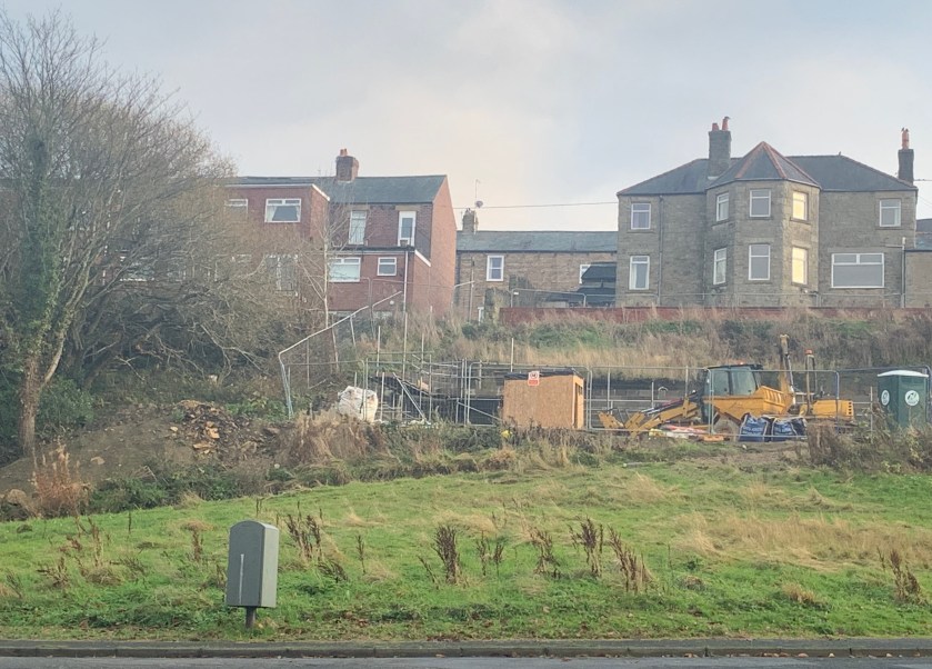
There is a significant storage of materials off site, including spoil excavated from the site itself which has been there over 12 months therefore is not temporary.
Can NCC please confirm that this is allowable and not contravening any duties bound under CDM, Environment Agency or local authority rules
Under Schedule 2, Part 4, Class A of the Town and Country Planning (General Permitted Development) (England) Order 2015, the developer can utilise land within their ownership directly adjacent to or adjoining the development site, temporarily, in connection with the ongoing development (which must have been given
planning permission by the Local Planning Authority).
There isn’t anything specifically set out within the regulations as to what the land can be used for, but includes storage of materials/material from site, storage of plant/machinery/tools, storage containers, portable toilets, car parking facilities – bigger developers sometime utilise this legislation to build freestanding site sales offices.
The caveat with using this legislation is that ‘as soon as reasonably practicable’; the use of the land for whatever it is being used for ceases, any development
(storage containers etc) are removed and the land is restored to its condition prior to the works being carried out.
This point refers solely to planning legislation – the storage of material on the land doesnt amount to a planning breach, but I cannot speak for other areas of legislation which it may fall within.
In the Design and Access statement it states that a path will be provided to the East of the site.
Can NCC please confirm that this is in place ?
I note the path mentioned within the D&M ; A statement and shown on the approved plan, I’ll speak to the developer and ask for further information in relation to this
The party wall boundary issues have highlighted the builders lack of competence, ability to do the work safely and NCC should be minded to ask to see a CDM plan and undertake regular site visits to ensure the safety of the people working there and also to witness the blight in the community.
CDM Plans fall within Health and Safety legislation which is dealt with and enforced by the Health and Safety Executive (HSE), I would suggest this point should be redirected to the HSE for comment
Where reference has been made to matters that are the remit of Building Control we will post the responses here upon receipt.
to the character and appearance of the area and would lead to an
unacceptable loss of open space of public value’
The planning application has now been formally refused for the following reason:
The proposed development would result in the loss of amenity open space that makes a positive contribution to the visual amenity and character of the site and surrounding area. The proposed development and the resultant loss of open space would have a harmful impact on the amenity of local residents, and would be harmful to the character and appearance of the area. The proposal would therefore be contrary to the aims of Policy BE1 of the Tynedale Core Strategy, Policies GD2, H32 and LR3 of the Tynedale Local Plan and the National Planning Policy Framework.
The County Council has previously maintained this area as amenity grass, cutting it on the same frequency as other public open space in the area. This was when the land was classified as public open space and the landowner had given us permission to do so.
The Council stopped mowing this area once the land class designation changed to housing land.
The cutting of the grass is explained as follows that if the land category has now been redesignated as public open space that we would seek permission from the new land owner to start cutting the grass again.
As planning applications are a matter of public record all relevant materials are available to view online through the public access system – https://publicaccess.northumberland.gov.uk/online-applications/search.do?action=simple
We do not enter into discussions or take reports via social media but offer a range of methods for residents to contact Gordon & Ken their County Cllrs
Contact us section https://prudhoeconservatives.wordpress.com/contact-us/
You can follow us on facebook & Instagram ‘Prudhoe matters’ and twitter ‘PrudhoeNland’
